In 2022 I had ended my planned through-hike of Roper’s Sierra High Route at Mammoth owing to smoke from a fire in Yosemite. In 2024 I returned to Mammoth to complete, if possible, the SHR.
This particular summer the start was a little bit more complicated than usual since the road from Mammoth Lakes to Red’s Meadow was undergoing repairs and the road was closed to all traffic, the USFS Red’s Meadow campground was closed as well.
This particular summer the start was a little bit more complicated than usual since the road from Mammoth Lakes to Red’s Meadow was undergoing repairs and the road was closed to all traffic, the USFS Red’s Meadow campground was closed as well.
I started on July 3rd since the USFS had indicated that they would be opening the road for July 4th traffic at noon on July 3rd. I took the shuttle to the Adventure Center to purchase a ticket for the bus that would take me to Devil's Postpile. Many other people had the same idea, unsurprisingly, and there was a long line waiting for the bus. There was also some kerfuffle about buying the bus ticket. The best way to do this is to purchase it online and then just pick it up at the ticket office in the Adventure Center. The company running the buses and the USFS were not on the same page and the left hand did not know what the right was doing. Pre-ordering gets around these coordination problems.
I found myself on the second bus leaving the Adventure Center, so not bad at all given all the conflicting information swirling around and the throng of humanity. From the bus stop I hiked to Devil’s Postpile to connect my steps from two years earlier.


Much of the Yosemite area was once covered by basalt. In most places this basalt has been eroded away as the glaciers moved across. The location now known as Devil's Postpile is the exception, here the basalt remains. Basalt is formed from lava and as the lava cools the nascent rock breaks into these pentagonal or hexagonal columns. The top photo shows the top end of these columns and the bottom photo a side-on view displaying the column nature of the rock. I have seen just about the same in Iceland and in Germany, it is an inherent property of basalt formation.
While there was some foot traffic around the Postpile, my hike to Superior Lake was an almost solitary experience. There was just one young couple heading back there and we swapped the lead a few times as we made our way. I camped at a well-used camp site at Superior Lake and scouted Nancy Pass for a bit. The ridge above Superior Lake has no fewer than three potential locations for Nancy Pass.
The one I chose, which happened to also have the plaque in memory of Nancy and therefore is the "real" Nancy Pass, is located Northeast of Superior Lake. Andrew Skurka’s map set indicates Nancy Pass to be more above the middle of the lake above some cliffs. Lastly there is information that Nancy Pass is immediately to the left (Northwest) of Red Top Mountain.
The one I chose, which happened to also have the plaque in memory of Nancy and therefore is the "real" Nancy Pass, is located Northeast of Superior Lake. Andrew Skurka’s map set indicates Nancy Pass to be more above the middle of the lake above some cliffs. Lastly there is information that Nancy Pass is immediately to the left (Northwest) of Red Top Mountain.

The plaque in memory of Nancy at the top of Nancy Pass


I did probably not find the best line up to Nancy Pass, climbing too far East and then contouring left towards a grassy slope. The best way up starts at the Northern end of the lake, then climbs a ridge which then transitions onto the slope. The best way to go was more obvious from the top rather than the bottom. From Nancy Pass you have a gorgeous view of the Minarets.
The next way point is a ramp leading up to Minaret Lake. I saw the top of this ramp from the pass and hoped to contour over to the ramp on the left side from Nancy Pass. What was not obvious from the pass is that there are steep slabs which will frustrate this game plan. Eventually I resigned myself to going all the way down on grassy benches to the right and then climbing the ramp from its very bottom.


At Minaret Lake
At the top I contoured right to intercept the Minaret Creek trail and then climbed it to the lake. Minaret Lake was busy, Bluetooth speakers blaring music. Uggh! I got the hell out of Dodge and made my way along a use trail towards the cliff below Cecile Lake. The use trail leads you right up to the wall and a V-shaped cleft (imagine looking at the V from above). While there is apparently a walk-around on the right, I did not have the necessary beta to know where exactly to look for it, so the climb it was going to be. I first tried, without pack, to climb out of the cleft up to the right, but it was a bit dicey and I would have to drag the pack over bedrock. Not attractive!
After studying this a bit more, I noticed that there was ladder-like series of steps on the left edge of the cleft and sure enough, five steps and I was up. I pulled the pack up behind me from on top. Easy-peasy!
I climbed over the berm to the shore of the lake to see what was coming next. To the right there was a giant and steep snow bank that dropped straight into the lake. If I was going to by the East bank of the lake that would have to be bypassed or crossed high up. On the left side the snow also reached right down to the water’s edge, alas not as steeply as on the right side. However there was way more snow to contend with on the lake’s left bank. So the right bank it was. All in all pretty straightforward, I did not even have to contend with the snow field as more options became visible as I climbed the convoluted terrain. I then made my way along the lake’s shore over talus to the far end of the lake where I crossed over more talus to its Northwest corner where the descent to Iceberg Lake begins.
Iceberg Lake had icebergs floating in it, go figure!, and the slope on the right side of the lake was one giant snow field. The descent is loose, partly sandy, partly talus as so many descents in the Sierra, and hence slow. As I reached the snow field I put on the micro spikes as it was getting late and the snow was no longer soft.


At the far end of the lake I found some camping with good views over Iceberg Lake and the remnants of Iceberg glacier. I was pooped, cooked some food and immediately hit the sack. Next morning I woke up early to clear skies and headed in the direction of Thousand Island Lake via Whitebark Pass. I immediately crossed the ice-cold outlet of Iceberg Lake and then followed a use trail on the left bank. I made my way cross-country to a bowl below Mt. Ritter and Banner Peak, crossing two vigorous streams separately rather than after they had combined to flow into Ediza Lake.
Climbing up along the stream coming down from Mt. Ritter/Banner Peak I soon found a use trail that led me easily to the bowl below the peaks. There I took a right turn and contoured in direction of Whitebark Pass high above the Nydiver lakes. It was a bit convoluted but not difficult. The top of the pass had thawed out, but on the West side a giant cornice covered the entire length of the pass. Some of the easier descent routes mentioned in Roper’s book were not accessible and, standing on the top of the cornice, you could not see the snow slope in its entirety, so the snow was too steep to go down. After some scouting I persuaded myself that on the right side the slope was not quite as steep and that I could down climb over talus to a snow field and then slide down across the snow as long as I did not build up too much speed as there was a talus field at the bottom that would stop me pretty brutally if I lost control. And, with caution, that’s how I got down Whitebark Pass, hitting a faint trail as I reached the talus that led me down to the meadow East of Garnet Lake. Climbing the meadow to the left and then a dog-leg right got me to the ridge overlooking Thousand-Island Lake and then down to its shore. With the previous day’s adventure still in my bones, I decided to make it a shorter day and to camp right there. Beautiful afternoon!


Next morning I climbed up to North Glacier Pass overlooking Lake Catherine. There was still a lot of snow below the pass and unfortunately I lost the use trail that I had hit upon and followed in the lower reaches of the hillside. So this climb turned into somewhat of a talus scramble/time sink. I saw the trail again very high up as it emerged from the snow. It runs very far left as you ascend and it’s definitely worth your time to try to find it.


At the top there was a magnificent view of Lake Catherine and of the snow fields dropping into it. I made my way down straight to the water’s edge and then scrambled over talus to the lake’s outlet. From the other side it looked as if there was a trail or “trail” going down diagonally from the pass in the direction of the outlet. Might be worth checking out, but the route along the shore is not too bad.
I followed the outlet stream to where it makes a sharp right turn and starts to cascade down the cliffs. There was an easy crossing right before the turn and from there a Class 2 down climb to a meadow above the second set of cliffs that you have to cross next. I did not have much information so I started off following the path of least resistance until I spied a grassy ramp very far to the right. I decided that that was my way to get down and that I would not try to climb down through the wall below me. All I had to do was to contour over there. There was some up and down and the ledges were narrow in places, but overall I was happy with how this worked out. The ramp was indeed an easy walk-down and I then continued on a use trail to the cluster of trees far below that Roper mentions.
After a brief rest I contoured further to the right until I reached the gully that has an old mining trail from the late 1800’s or early 1900’s running through it. Some rocks have fallen onto the path in the intervening decades, but the descent is straightforward. At a convenient point you leave the trail and head cross-country for your next objective, Twin Island Lakes. It’s a x-country stroll.
As you reach the first of the two Twin Island lakes, you squeeze by between the lake shore and bulk rock in intricate terrain with short sight lines, crossing gullies and climbing ridges where the next 100 yards are revealed to you. Quite fun, actually. You then need to ford the outlet of the lake. The water is incredibly clear (and cold!!) and it is quite difficult to gauge the depth of it. It reached right to my crotch. Did I tell you that it was cold, very cold? I pity the longitudinally challenged.


Beautiful view from the meadow past the ford back across the lake and a patch of Indian Paintbrush.
Getting past the second lake was easier and soon I found myself in the notch that Roper mentions. The next objective was Bench Canyon which you could see ahead. I found Roper’s instructions confusing as I did not see the grassy slopes he mentions. I just saw a slickrock bench which I climbed up only to find myself ending up in a talus field. In retrospect I think Roper wants you to go left and low across the ridge that I climbed erroneously. After descending the talus field I had ended up on I found myself roughly where Roper wants you to go. There was some scrambling across loose rock, but after that I found myself on a grassy slope that got me down into Bench Canyon without issue. I camped there in a beautiful meadow on a beautiful evening.


Bench Canyon really is a spectacular, bucolic setting. Lots of flowers, lots of water and gentle grassy slopes. Enjoy it while it lasts, because past Blue Lake and past Blue Lake Pass in particular, things get a lot rougher. From Blue Lake you climb to the pass on steep grassy gullies, over some talus and slick rock. The sight lines are short and up high things don’t work quite the way you had imagined them to go when looking up from down below. But overall it’s fun.


A view of Blue Lake from the pass
 A view from Blue Lake Pass to the North. White outcropping slightly to the right of the center line of the image
 During the traverse from Blue Lake Pass
 The bench below Foerster peak
Next morning I headed North cross country in search of the remnants of the trail which would lead me to Isberg Pass and indeed with some imagination one could see that there had once been a trail, the rocks were not arranged totally randomly and as I climbed towards what I imagined to be the pass the path became increasingly more obvious. The down climb was easy because there the trail is in good shape.
The Lyell Fork was running high right where the trail meets the stream, but slightly downstream the creek makes a right turn and the crossing directly in the turn was straightforward, The trail on the other side was in good shape and led straightforwardly into the Lewis Creek drainage. This drainage is a very good illustration of the interplay of rock, water and trees that the Sierra is famous for. Here I ran into the first people I had seen in a long time, since around Thousand-Island Lake, in fact. I camped in the forest near the branch to Bernice Lake.
 Reaching the Lyell Fork
 Look upstream of the Lyell Fork

 Lewis Creek

 Views near Vogelsang
 Tarn atop Vogelsang Pass

 Views along the climb of Vogelsang Pass
 Phlox
Phlox
 Monkey and/or musk flower (Erythranthe erubescens)
 Mountain Pride (Penstemon sp)

 Heather (Cassiope Mertensiana)
 Wild buckwheat (Eriogonum umbellatum)
 Phyllodoce breweri
 Tunic flower (Petrorhagia sp)
 Sierra Tiger Lily
 Hoary Tansy aster (Erigeron grandiflorus)
 Rhododendron columbium (Western Labrador tea)
 Leichlin's Mariposa Lily
 Larkspur (Delphinium polycladon)
 Shooting Star


I found the view from the pass onto the bench below Foerster Peak somewhat intimidating, a mixture of talus and cliffs with more cliffs right below and out of sight. I decided on a long traverse from the pass towards a white outcropping about 3/4 of mile to the North as a way to get across the talus bowl North of Blue Lake Pass. It was slow work but I did get across and that’s all that counts. I then strolled across the gently undulating plain in direction of peak 11210, turned left right in front of it and made my way to the forested slope to the West of it. The map shows the Isberg trail running through there, but that has apparently been abandoned for a long time. I saw nothing trail-like at the altitude indicated on the map. I camped in the forrest near running water.
Next morning I headed North cross country in search of the remnants of the trail which would lead me to Isberg Pass and indeed with some imagination one could see that there had once been a trail, the rocks were not arranged totally randomly and as I climbed towards what I imagined to be the pass the path became increasingly more obvious. The down climb was easy because there the trail is in good shape.
The Lyell Fork was running high right where the trail meets the stream, but slightly downstream the creek makes a right turn and the crossing directly in the turn was straightforward, The trail on the other side was in good shape and led straightforwardly into the Lewis Creek drainage. This drainage is a very good illustration of the interplay of rock, water and trees that the Sierra is famous for. Here I ran into the first people I had seen in a long time, since around Thousand-Island Lake, in fact. I camped in the forest near the branch to Bernice Lake.


Next morning I hiked up to Vogelsang Pass with stunning views along the trail as I rose. I passed near Vogelsang Camp which was dead, but a short while later I encountered a Forest Service mule train carrying gear and equipment to start up the camp. The hike out to the 120 corridor was long and dusty but entirely straightforward. The mosquitoes near the Lyell Fork were hungry, though!


I ended at the Tuolumne Post Office, the store being closed for renovation, took the 7 PM bus to Mammoth Lakes to get ready for my hike of the Southern Sierra High Route. Three passes to go for the SHR to make it all the way to Twin Lakes coming up this summer (’25) before I hike the Yosemite High Route.
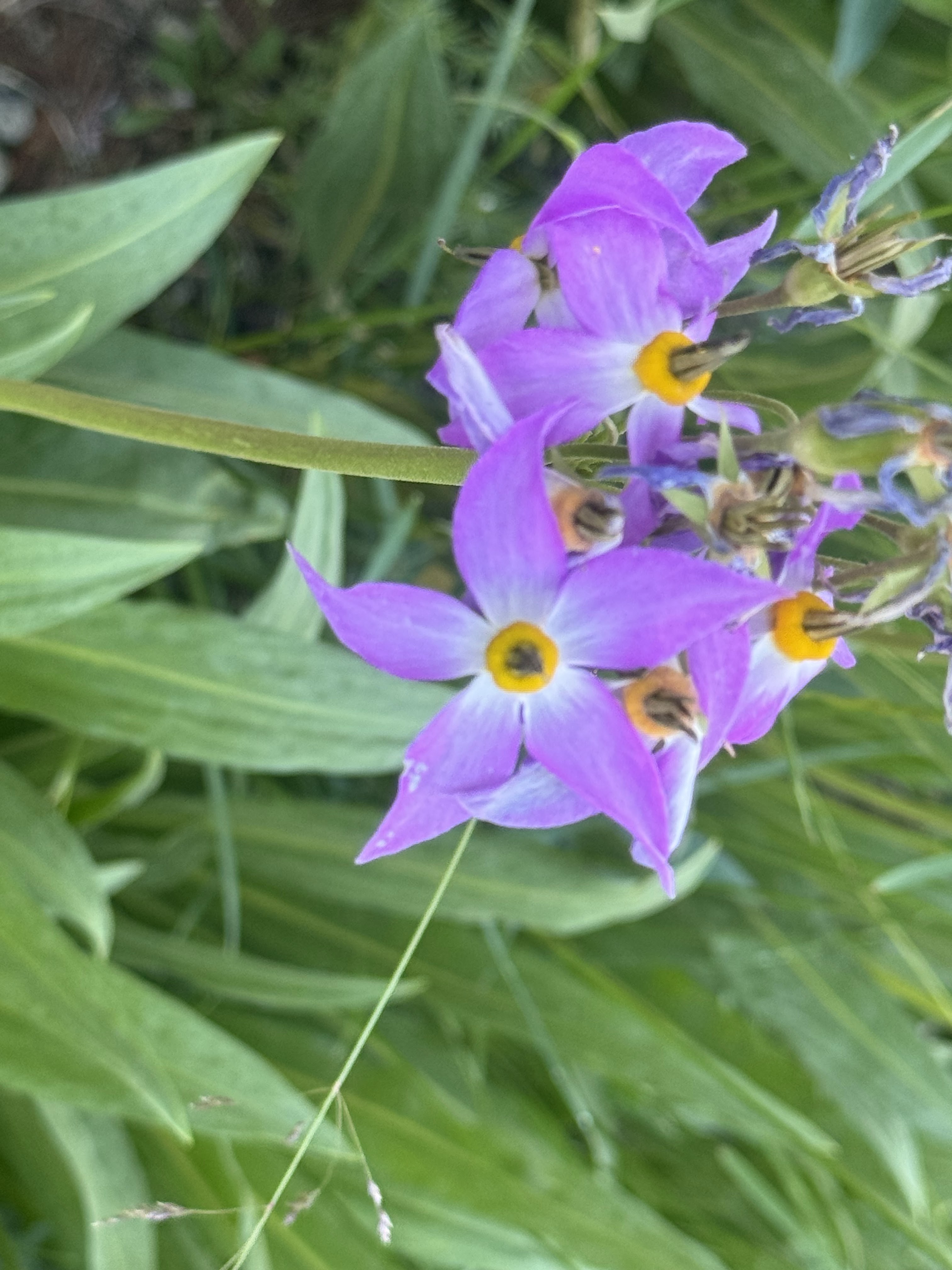
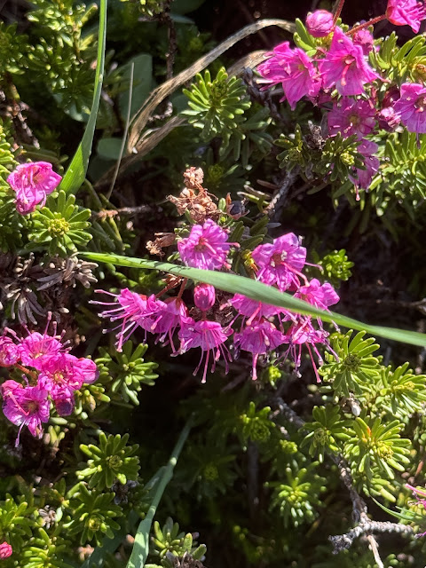
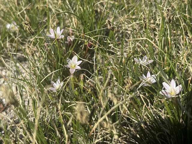
And some bonus botanical content: